HAVE A GREAT DAY
TAKE CARE OF YOURSELF
& YOUR FAMILY


Showing posts with label National Parks. Show all posts

Friday, October 7, 2011

Uluru-Kata Tjuta National Park in Northern Territory

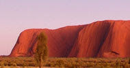
Uluru stands 348 metres high, with most of the rock's bulk hidden beneath the earth. Research suggests that Aboriginal people have been in the areas for 22,000 years or more.
Uluru is 461 kilometres south-west of Alice Springs, and a must for campers and travelers to visit.
Uluru is one of the great natural wonders of the world and is accessible via sealed roads off the Lasseter and Stuart Highways.
Four Wheel vehicles and campers can access the park via The Red Centre Way and also via the Great Central Road from Western Australia.
Darwin and Alice Springs have tour operators that visit Uluru on a regular basis for tourists.
Uluru was known as "Ayers Rock". In 1985 it was returned to the care and ownership of the Anangu people who now manage the park jointly with Parks Australia.
Visitors who experience sunset or sunrise of Uluru from a viewing area are always rewarded with the remarkable changing of colors. If there is a cloud in the sky, the colors on the cloud formations can be equally stunning as on Ulura itself.
We have visited Uluru many times and always enjoy the area.

Organise your next holiday to see Uluru, through Discover Australia.

Friday, August 26, 2011

Cable Mountain-Lake St Clair National Park. Tasmania

Cable Mountain is listed by the World Heritage Commission as one of the most precious places on earth and is part of the Tasmanian Wilderness World Heritage area.
This area contains rugged mountain peaks, steep forested gorges, moorlands, rainforests, glacial lakes and tarns.
The National Park is a veritable magnet for all lovers of nature. Prolific wildlife found in the region incorporates many migratory species of birds, such as wrens, honeyeaters, and robins, which depart the high country in winter and head towards coastal areas, leaving the park to the resident bird life, which includes eagles, currawongs and parrots.
Nocturnal marsupials populating the area include wombats, possums, spotted-tailed quolls(tiger cats) and the famous Tasmanian Devil.
Numerous walking trails ( all signposted ) from easy, intermediate and hard, crisscross Lake St Clair National Park. A popular 6 km walk track  around the shores of  Lake Dove and pass the  imposing spires of Cradle Mountain is believed to be Tasmania's premier walking track.
We last visited Tasmania in March 2000.  We obtained all the necessary camping permits enabling  us to camp in National, Conservation and general camping areas.  We spent one month travelling Tasmania- nowhere near enough time.   We are planning to return and have no time limit. 
Cradle Mountain has a Lodge offering the traveller a warm haven against the fickle and often inclement weather of the Tasmanian highlands. 
There is no camping in the Cradle Mountain day-walk areas.  Shadow Lake has camp sites where you can enjoy superb lake and mountain views.  Lake St Clair Wilderness Holidays, 5 km north of the Derwent Bridge has camp sites, backpackers' accommodation and luxury cabins.


We camped at Lake St Clair camping area and found the staff very helpful with information about the Lake and also the surrounding areas.


So go and explore Tasmania - organise your next holiday through
Discover Australia.

Thursday, August 25, 2011

SIMPSON GAP


                             Only 18km west of Alice Springs in the Northern Territory 
campers and travellers will find
SIMPSON'S GAP
Simpson's Gap


                   Small delicate wildflowers at Simpson's Gap
Sunlight coming through Simpson's  Gap
 
Simpson's Gap is accessible by 2 wheel drive
and is open from 5am to 8pm.
Camping nearby is permitted ( fees do apply),
Disabled access, information displays, toilets, drinking water, 
BBQ facilities, picnic facilities, marked walking tracks, 
A lookout and even a bicycle track are  provided.
There is an annual bike ride from Alice Springs
to Simpson's Gap
proving to be very popular with locals and visitors.
(Just recently held in August)


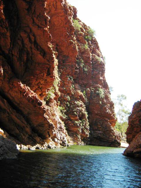
Looking back upstream from Simpson's Gap


Camping is permitted at a special camping area.
  A small fee is payable to the Ranger or in the honesty box provided.
These light and easy to erect tents are popular the hikers and campers alike.


                                        Come on everyone
                        get out and explore your world
                        there is so much to see and do
                        Life is too short to stay home and watch the box!

Wednesday, August 24, 2011

Innes National Park. South Australia


Innes National Park view from Cable Beach 
Innes National Park is located on the Yorke Peninsula.
Outstanding coastal scenery, top surfing and  great fishing keep bringing campers and holiday makers  back  often to this beautiful National Park.
Most of the roads in Innes National Park are now 2 wheel drive accessible.
The wild coast is protected in most places by sheer high cliffs and probably the best spot to  experience such a dramatic scene is at the Gap, near Reef Heads.
Pondalowie Bay further north has protected waters and is the most popular camping  area.
Other areas to camp are Cable Bay, Gym Beach, Shell Beach and other smaller areas.
National Park and camping fees do apply.  


"Gatehouse Lodge" for accommodation


Other accommodation is available at the Inneston Heritage Village by contacting the local Ranger ( phone number we had was (08) 88543200).


Innes National Park have a very well equipped  visitors information centre
The Stenhouse Bay Trading  Post has basic supplies and fuel.
National Surfing Championships are held in Innes National Park on occasions.


Inneston Old Post Office restored
View from Cape Spencer Lighthouse

Tuesday, August 16, 2011

Currawinya National Park. Queensland

The Currawinya National Park is a semi-arid park and was establisted in 1991 to protect the area's freshwater lakes, which are an important refuge for inland birds in times of drought.
Black Swans, Pelicans and many duck species can be found at Lake Wyara.
Lake Numalla in the north west of the park is a 220 hectare body of fresh water.
Access to the park is via Cunnamulla and Eulo, Bourke or Thargomindah.  4WD is recommended but we have seen 2WD vehicles in the park.  Always check  road conditions before going into Currawinya National Park.  The local shire/council  keep the gravel ( unsealed ) road is good condition most of the year but it does depend of weather conditions.
There are no designated walking tracks in the park, but the bird life make up for it.

  Fishing is permitted in the Paroo River ( you do not need a permit) but not in the freshwater lakes.
Currawinya National Park is a remote park with no real facilities, therefore campers must be self sufficient and go well supplied with food , water and fuel.  
There are plenty of bush camping sites where only minimum camping permit and camping fees apply.

If you have children travelling with you, a good book about Australian Birdlife to keep them interested.

Monday, August 15, 2011

Boodjamulla (Lawn Hill) National Park. Queensland/Northern Territory border

Northwest of Mount Isa approximately 400km is the Boodjamulla National Park. The park  is a favourite spot for nature lovers and campers from all over Australia and now includes International visitors.
Lawn Hill Gorge which cuts its way through the sandstone plateaus of the Constance Range. The 60 metre walls of the gorge protect the warm clear water in the pristine waterway.
Lawn Hill Creek is a permanent watercourse, fed from many springs. Freshwater crocodiles live in the park and although they look dangerous, they are not usually a threat to people.
Riversleigh section of the park has the Gregory River flowing through. The World Heritage listed fossil deposit of prehistoric mammals and reptiles remains can be found here..
The Highlands Plains area being north-west of the Lawn Hill Gorge is a designated wilderness region therefore no access to vehicles is permitted.
Boodjamulla is a haven for a variety of wildlife  with  over 135 species of birds, 36 different types of mammals, and  snakes and lizards.
Campers should allow at least 3 to 4 days to enjoy Lawn Hill.  20km of walking tracks with the 7km return walk to the upper gorge which passes through a wide variety of diverse habitats a must to do.
The road to Boodjamulla is a gravel (unsealed) road. The road can be access by 2WD but 4WD is recommended. Visitors must be self sufficient in food, fuel, camping supplies and vehicle spare parts as the nearest place is Gregory Downs Hotel some 100km east of the park.
Camp sites have toilets, showers and fireplaces ( although it is best to have your own fuel source - Gas Stove). Collecting firewood in the park is prohibited.
There is an excellent privately owned very popular camp site - Adels Grove- only 10km from Lawn Hill Gorge.
Take your own inflatable boat or canoe- or you can  hire from Adels Grove  - and enjoy  peaceful hours  paddling along and exploring the creek.
The red cliffs around Lawn Hill Gorge are covered by rain forest plants, with much of the park being grassland and open forest.
During the wet season, access can be cut for weeks at a time and the roads closed.  
We contact the RACQ on 1300 130 595 for the latest report before going to Boodjamulla.
Best time to visit is June to September.


Wednesday, July 20, 2011

Lake Eyre National Park. South Australia

Lake Eyre is Australia's largest salt lake. 
 Lake Eyre covers over 8000sq km and is the largest salt pan in the world. 
Until 2010 the previous 100 years the lake had only  a significant amount of water in it about six times.  Weather conditions in Queensland and New South Wales caused the Cooper River to flood and water came into Lake Eyre two years in a row. Most unusual but most rewarding to the countryside. The wildflowers and spinifix reformed the area for hundred of km's.
Lake Eyre South, just off the Oodnadatta Track, 90km west of Marree is the easiest access.  
A 4WD track via Muloorina homestead and another south of William Creek lead to the lake.
Can you see our camper ?
Muloorina homestead ( gravel road out of Marree)  have provided a great camping area for travellers with artesian bore water flowing into two main water holes.  In summer the area is like a oasis and swimming is enjoyed by all that travel to the area.
The Muloorina homestead only charge a very small camp fee.
 Campers have to be self sufficient but there are toilets provided. 
 The nearest shop is at Marree.
When going through Marree - the roadhouse has the BEST bread- yummy- made the old fashion way and you have to order to make sure you obtain some.

To be self sufficient a good gas stove is the way to go. 
 Camp fires are not recommended during the dry season.

Friday, July 15, 2011

Alpine National Park. Victoria. Australia

Alpine National Park is Victoria's biggest park and one of Australia's finest.
Alpine National Park has rugged mountains, remote snowfields, beautiful  rivers, open plains and deep gorges which open out to reveal green valleys.
The alpine region is ever-changing: snow covers the upper reaches for most of winter, while summer brings heat to both the lower reaches and the mountain tops.  The weather can change from extreme heat to freezing temperatures very quickly.  Snow is not uncommon during the summer months.
The Crimson Rosella is found in and around the tall trees in the eucalypt forests and woodlands of the park.
Other bird life that visit the park include the noisy gang-gang cockatoo, rosellas and long-beaked wattelbirds.
The park extends across the Great Dividing Range from Mansfield through to the border with New South Wales.
Best time to visit the park is all year round. 
Skiing in the winter, swimming, walking, 4WD, cycling, horse  riding, canoeing, nature study, photography, and historical interests.
Visitors to the park can access to the beautiful Bindaree Falls from Mount Stirling Circuit Road which winds through sub-alpine and alpine forests.
Hiking at Falls Creek on many of the accessible walking tracks when the snow melts is very popular with campers and visitors.
There are approximately 7 to 8 camp sites  throughout the park.
On Cowombat Flat one of the popular walks there is  a wreckage of a DC-3 aircraft that crashed in 1954.
I have only given you a very short description of this beautiful park.
Alpine National Park covers about 646.00 ha.

Monday, May 2, 2011

NEW SOUTH WALES ( AUSTRALIA) NATIONAL PARKS

Lots of areas to camp, explore and really enjoy in New South Wales.
There are approximately 67 national parks in NSW. Around 5 per cent of the state has been  set aside for parks and reserves.
The largest  single park,  Kosciusko National Park ( 646 911 ha) located in the south-east of the state. It contains Australia's highest peaks, its most extensive ski fields and a spectacular display of spring wild flowers.
Even larger than Kosciusko is the combined area of three adjoining parks to the west of Sydney, namely Blue Mountains National Park, Wollemi National Park and Kanangra-Boyd National Park.
Wollemi, which contains Australia's largest area of unaltered forest, is a wilderness that can be enjoyed only by experienced bush-walkers. 
Kanangra-Boyd is similarly wild, although parts of it are accessible along a number of trails.
The Blue Mountains, however, contains some of the state's most familiar scenic attractions, including the Three Sisters, Govett's Leap and Wentworth Falls.
Myall Lakes National Park is a complex of coastal lakes and waterways on the north coast.
Royal National Park on the outskirts of Sydney I believe was Australia's first national park.
Warrumbungle National Park in the state's north-east  has a strange landscape of eroded volcanic peaks
Hope I have wet your appetite to get out and see this beautiful country. Arrange your next holiday through our web site and Discover Australia.
Please leave a message if your require any more information.

Sydney Harbour Bridge and Opera House

Sunday, May 1, 2011

Australian Capital Territory Namadgi National Park

Although about 46 per cent of the ACT is set aside for parks and other reserves, there is only one national park. Adjoining Kosciusko National Park in New South Wales,  Namadgi National Park approximately 94 000 ha, occupies more than one-third of the Australian Capital Territory(ACT).
To discover and explore Australia you can book all your travel arrangements through our web site.
Namadgi National Park

Saturday, April 30, 2011

Australian's National Parks

Travel and explore AUSTRALIA and all it has to offer. Whether you go camping,  RV'ing,  Hotel or Motel accommodation style, or your own caravan.  National Parks have so much to offer.

National parks are only one of many types of reserves dedicated for nature conservation in Australia. The others include nature reserves, historic sites, Aboriginal sites, game reserves and scientific areas.
Altogether there are more than 3200 nature conservation areas in Australia, including 665 or more national, conservation and other parks, which occupy nearly 410 000sq km. or just over 5 per cent of the continent's land area. In addition there are more than 220 protected offshore areas, such as marine parks, aquatic reserves, fish sanctuaries and historic shipwrecks. These aquatic areas occupy approximately 384 000 sq km. Beyond Australia's coastal waters there are two other national parks, Christmas Island  National Park and Norfolk Island National Park, as well as national nature reserves that protect reefs and cays to the north and east of the continent. Two of these nature reserves, Coringa Herald National Nature Reserve and Lihou Reef, have a combined area of approximately 17 300 sq km.
National parks  are set up and managed by the states and territories, each of which has its own definition of exactly what constitutes a national park. Generally the term is used for large areas of outstanding interest or beauty that have been set aside for protection, education and public enjoyment.  Some states have a number of categories for parks. South Australia, for example, distinguishes between national parks and conservation parks, the latter being less developed and receiving fewer visitors. Only two mainland parks are administered by the Australian National Parks and Wildlife Service, namely Uluru and Kakadu, both in the Northern Territory.

Wednesday, April 27, 2011

Nuytsland Nature Reserve

Incorporating the cliffs of the Great Australian Bight and ocean beaches, Nuytsland Nature Reserve encompasses close to 500km of coastline and stretches from Cape Arid National Park eastward to Red Rock Point. The Eyre Bird Observatory and sections of the old Overland Telegraph Line,constructed in 1876, are within the reserve. Access to the west of the reserve is by four-wheel-drive along Fisheries Road through Cape Arid National Park. This is a remote area and recommended for self-sufficient campers only.
There is a Park Entrance fee obtained from the Cape Arid National Park about $10 per vehicle.
Point Malcolm camping area is a small site near beach access area.
Much of the trip includes long distance beach driving, rough pavements, extensive scrubby stretches and some deep sand plus some easy dune driving making this trip suitable for experienced 4WDers only. Telegraph Track sections are generally slow going over firm sand with extensive limestone outcropping. The limestone significantly slows progress as does encroaching scrub – expect scratches. Evidence of the Telegraph is seen by the occasional remnants of poles and insulators and for long stretches, a single steel wire snakes along the route.

Monday, April 25, 2011

National Parks in United States

National Campgrounds
This is an excellent guide to the fifty-eight national parks. It doesn't matter whether you are interested in week-long back-country hikes, overnight camping, a long hike in the woods, sight-seeing, or just driving through: this book is an in-depth guide to the parks, their history, their features, and what you need to see, bring, and know. This book  is a guide to some National Parks and  historic sites . This book is it's sixth edition because it is that good. Buy it and pack it with you. 

This book is amazing. It is very well written and well organized. This book has  beautiful pictures. Many take up the entire page. The information is very well presented - quite interesting. This is a great resource as well as a great coffee table book.

A camping holiday in  National Parks anywhere in the world is truly an experience you do not want to miss.
 Looking for camping gear check out our website.

Thursday, March 31, 2011

Thomas River Esperance

Thomas River is an attractive area popular for beach and rock fishing. Southern Right Whales visit during the winter and early spring months. The bay has very hard white sand, gorgeous turquoise colored water and big rolling waves. 4WD access to the beach between the river and the rive mouth via a small track. The Thomas River is very shallow and not very appealing, but the beach well and truly makes up for it.
Bird watching is  popular with  numerous walk trails through the area.
Two camping areas run by CALM. One on a hillside overlooking the river and ocean. Quite a few cleared sandy bays recessed into groves of predominantly banksia trees. Fairly sheltered although there was a bad bush fire couple of years ago and  they are slowing growing back. Several bays quite large enough for big caravans or RV's.  The walk trail to the beach is about 100metres. Very good facilities with  new facilities  being built for the tourists on this site.
The second camping area is in dense shrubbery beside the Thomas River. You can not see the river because of the vegetation. The area is sheltered and has good facilities but not much shade.
No pets are allowed.  Best time to go would be Spring, Summer and Autumn. You will need a National Parks Pass and camping fees apply. 
The photo shows our view from the hill camping area just after the bush fires. 
It is a very pleasant spot and the white beach just goes on  and on. 
Suitable for all vehicles to enter the park


Wednesday, March 30, 2011

Le Grand Beach Esperance

Very popular for camping, fishing, swimming, boating, walking, nature study and wonderful scenery.
 A solid rock headland is good for fishing and the beautiful beach sweeps round in a wide arc towards the town of Esperance which is  approximately 30kms to the west. Turn off Merivale Road and go  about 12kms to the Rangers Office. Quite expensive to camp here but it is a beautiful place.  You need a National Park's Pass plus camping fees.   The showers are only solar powered so there is no guarantee of a hot shower depends on how many other campers are there and also if the sun has been out or not.
Best time to go is between September and November when the wildflowers are in abundance. Summer is a great time to go for the swimming. It can be cold, wet and very windy during the winter months.
When we were here there was a brick ablution block with flush toilets, wash basin as well as the solar showers. Depends on the rain fall there should be rain water available, a campers kitchen, gas barbecues, tables and seats, bins, some shade and lots of nice walking trails.  Small boats can launch with a 4WD but it would be better to go to Lucky Bay.  Generators were allowed but at certain times during the day.  Camp fires are not allowed.
There is a day picnic area near the beach parking area.
The camping bays have thick protective vegetation surrounding the site, therefore you can not see the ocean even though it is right beside the ocean.  Just a short walk.
Most mornings are calm and perfect for swimming then the sea breeze comes in the early afternoon on a average day making it right for the fishing  or get a good book ( or Kindle) to read and relax.
Go and enjoy if you are in the area.


Monday, March 21, 2011

Waychinicup National Park

Waychinicup National Park goes from Norman's Beach in the west all the way across to Mount Manypeaks to Cheyne Beach in the east.  This park is very popular with canoeists and fisherman.
It has magnificent coastal scenery and once again in Western Australia the spring weather produces wildflowers full of color.
Waychinicup is accessable by most vehicles, and camping is at the Inlet Camping Area for tents only as you have to walk into the camp area.  Sorry no dogs allowed.  Bring you own drinking water. There is a ranger in attendance and a campground host during the peak season.   .http://nationalparkguide.com.au/western-australia/waychinicup-national-park/
We enjoyed our stay and walked a lot on the walk trails using our own walking sticks as excellent support especially on the steeper trails.

Sunday, March 20, 2011

Cape Le Grand National Park

Cape Le Grand National Park has beautiful beaches of Le Grankd, Hellfire, Lucky Bay and Rossiter Bay. Rocky headlands and magnificent rugged coastal scenery features in this park. During early summer wildflowers are abundant.  The area is popular for swimming, fishing and whale-watching. The park is approximately 36km east of Esperance in Western Australia. Easy access via the Cape Le Grand Road off the Merrivale Road.
There is a very good 4WD beach area near Marbellup Hill.  Rossiter Bay has very enjoyable walk trails for those campers interested in walking.
Lucky Bay has two camping areas. One area is a carry in everything area, where the other section is  for tents,  van, trailer camping. There was a camp kitchen  and solar hot shower when we were there last time couple of years ago.  I would  recommend 4WD  for the beach boat launch  area.  The park only allows gas/fuel stoves. The Portable Butane Gas Stove shown is very popular and  lightweight for backpackers and campers with limited area for packing gear.